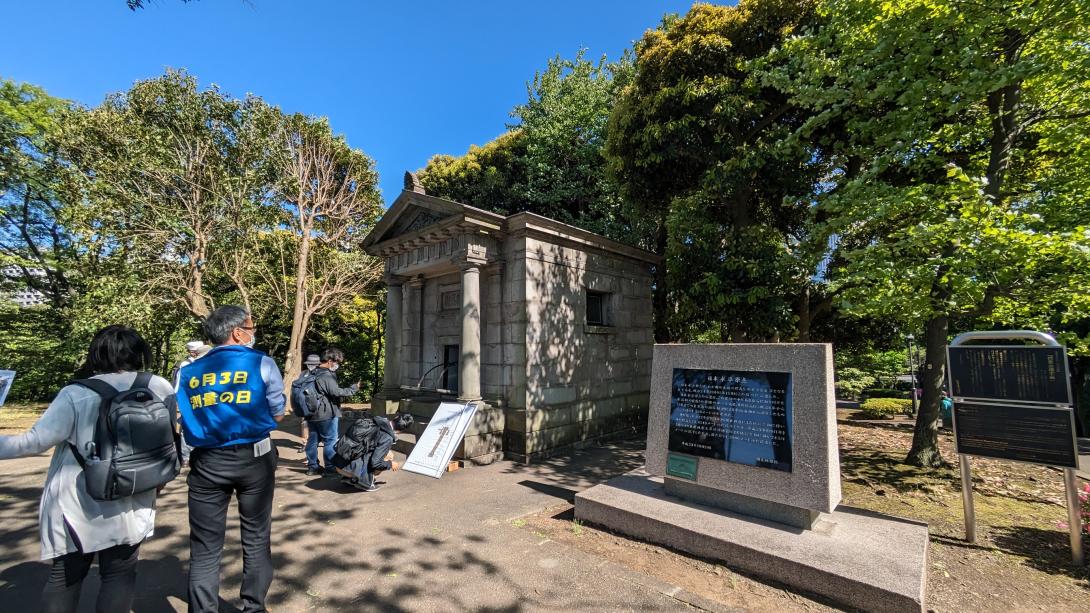
I went to see the Japanese datum of leveling, the parent of all level points in Japan.
In anticipation of Survey Day on June 3,
the lid of the origin of the level, which is usually closed, was open, and we were able to see even the level lines.
What is a Japanese datum of leveling
Although I honestly don't know much about it,
that leveling point is the place where the elevations of various places in Japan are measured.
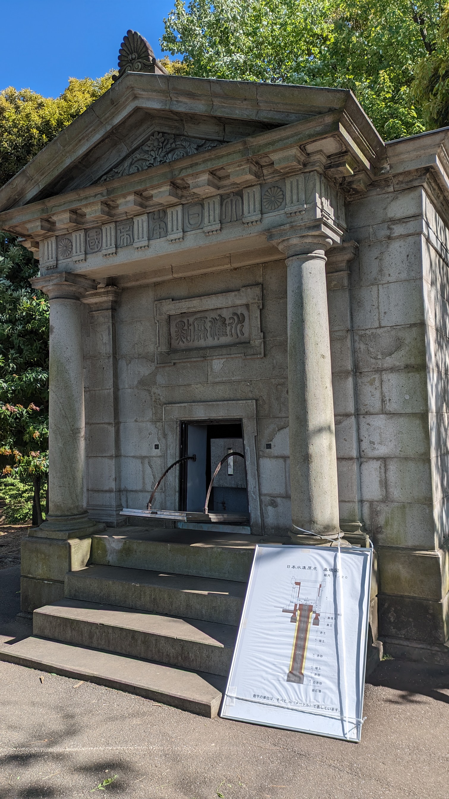
The level origin is located right in front of the National Diet Building, where one of the predecessors of the Geospatial Information Authority of Japan (GSI), the former military land surveying department, used to be.
The elevation of Karuizawa is...
When we say, "What is the elevation of Karuizawa...", of course we measure it by surveying, but
when we decide the elevation from where, we need this level origin.
It is the height from the sea, right?
When you think about it, if you wait for the tide to rise and fall, you can't survey at any time.
So, while continuously measuring the height above sea level and finding the average,
we fixed it on a sturdy piece of land and built this level origin.
After that, the value is determined by finding the height of the origin of the level from sea level.
Sea level is called Tokyo Peil (T.P.), and the origin of the level is at the height of T.P. +24.3900 m.
From this level origin, level points have been erected in every corner of Japan.
Opening day
To be honest, I rushed to the site after learning of the opening via Twitter on the day.
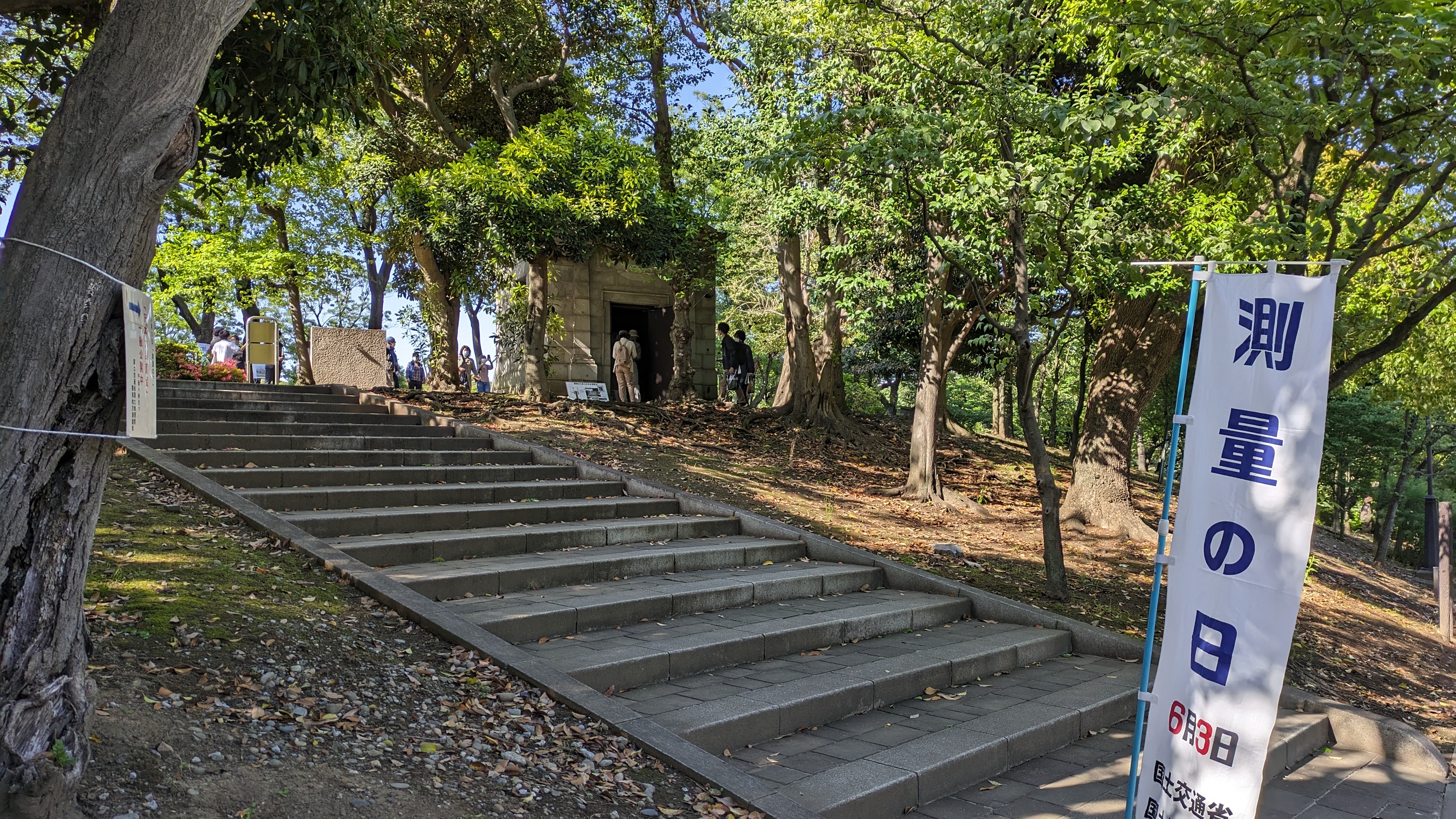
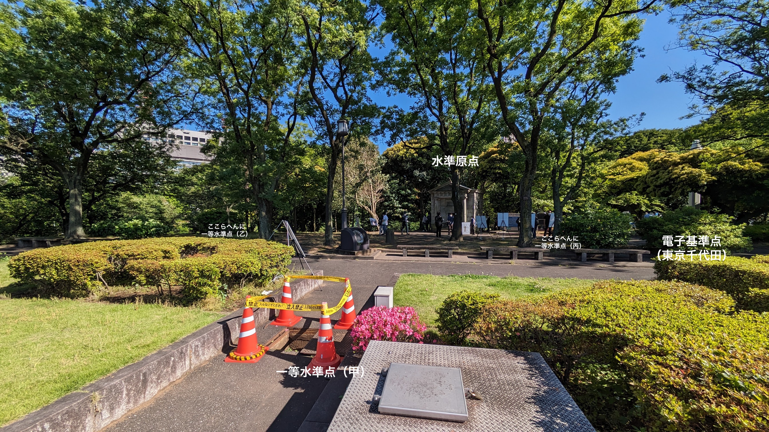
There is a level origin at the top of these stairs, on the right
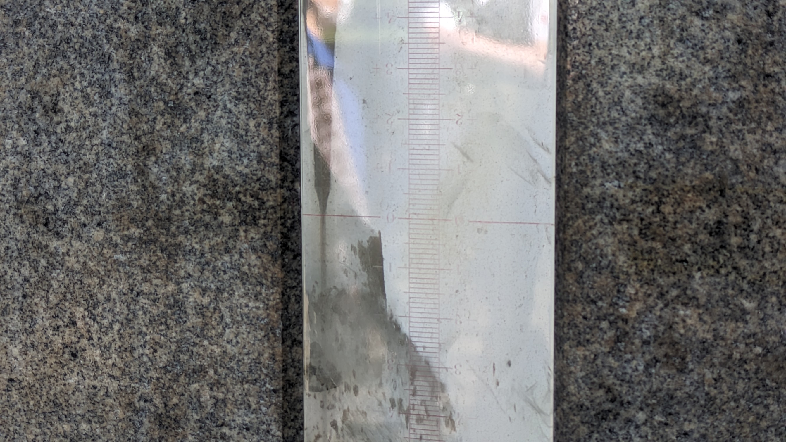
You can see the scale drawn on the glassy embedded within this stone.
The line of 0 is the standard for elevation in Japan.
It is +24.3900 m above sea level in Tokyo Bay.
And the stone in which the scale is embedded is ridiculously large so that the scale is not blurred.
When viewed from the back, the massive foundation can be seen.
In fact, the foundation is driven much deeper.
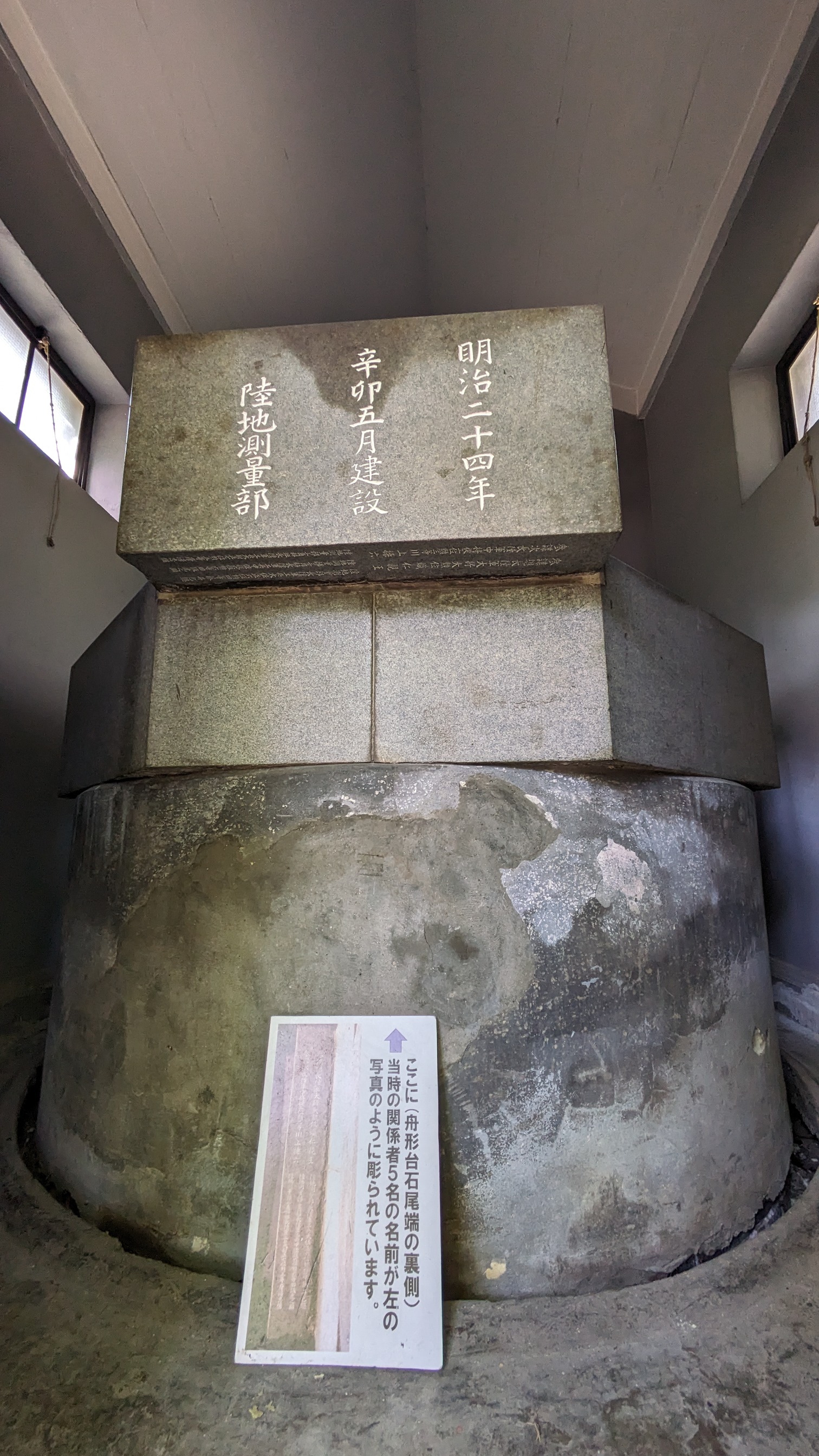
And to check the elevation of the level origin,
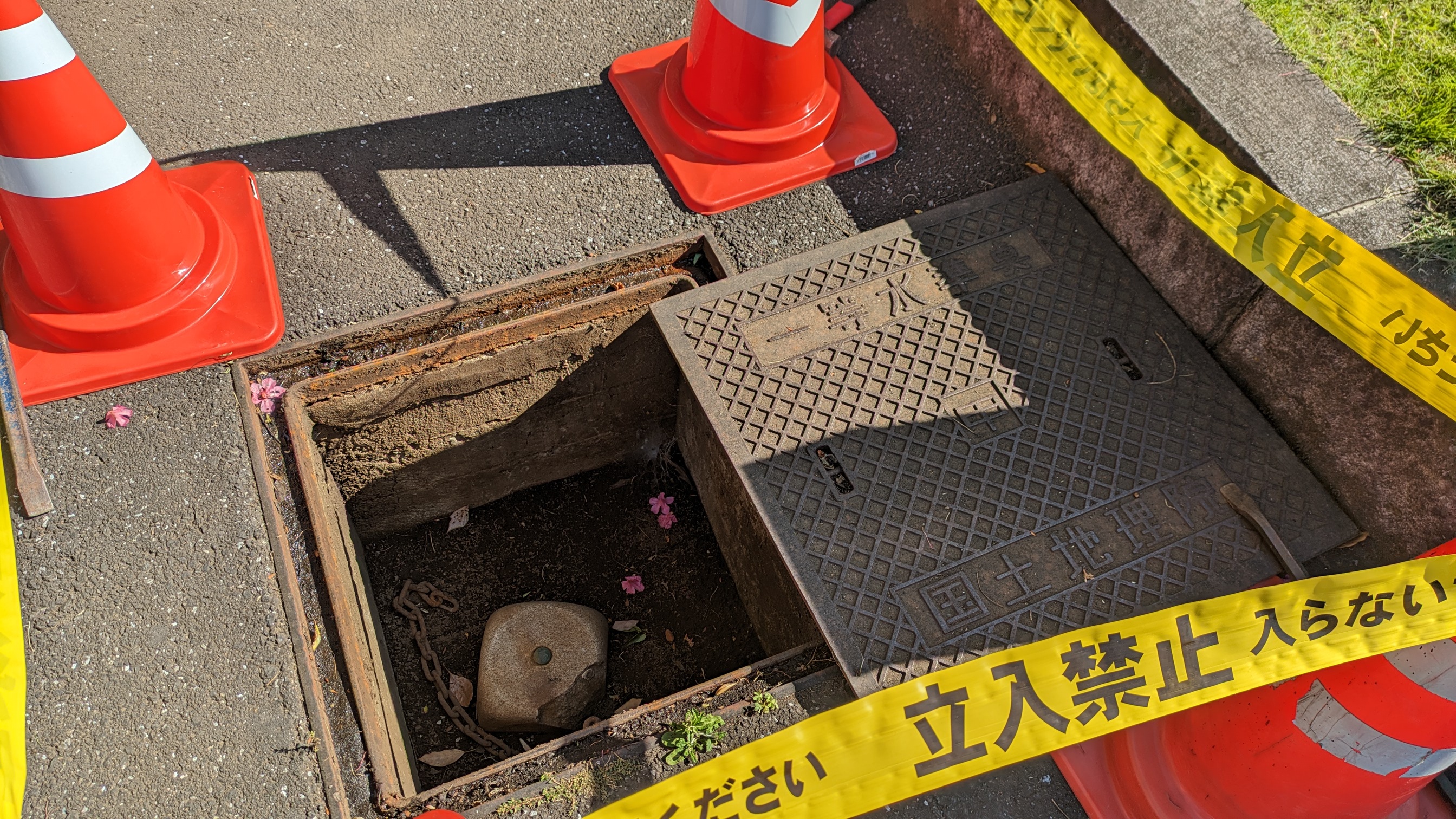
there are five first-class level points around it (A, B, C, D, Boshi).
Most of them are set underground, covered with steel plates.
This level point is more often seen.
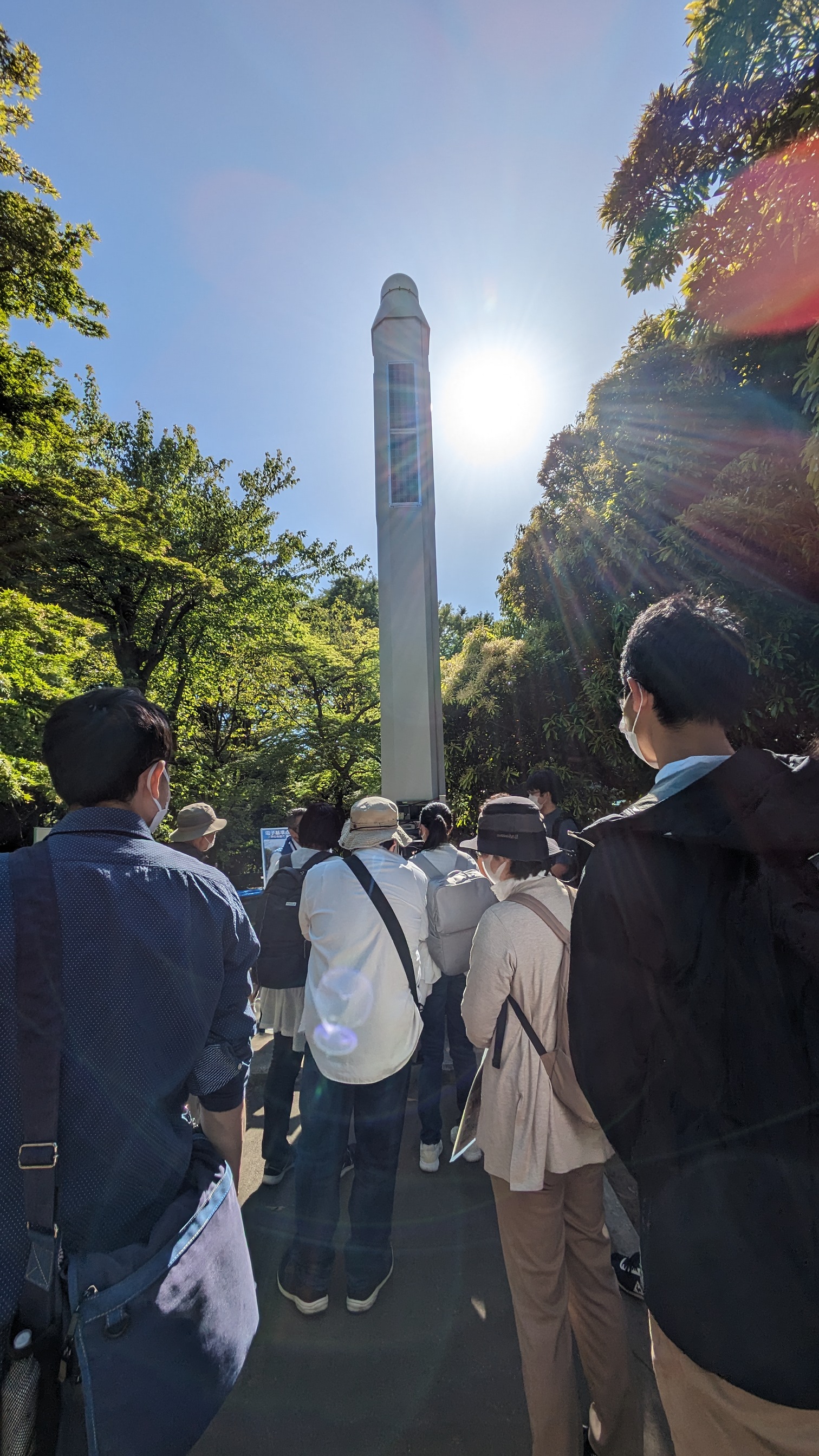
And next to the Japanese Level Origin is an electronic reference point.
It was the first to be established in the city center and is named "Tokyo Chiyoda".
This is the level origin (Tokyo Chiyoda)
It looks a little weird and divine. It looks a bit like a weird religious thing, but
these are surveying enthusiasts who gathered on that day.
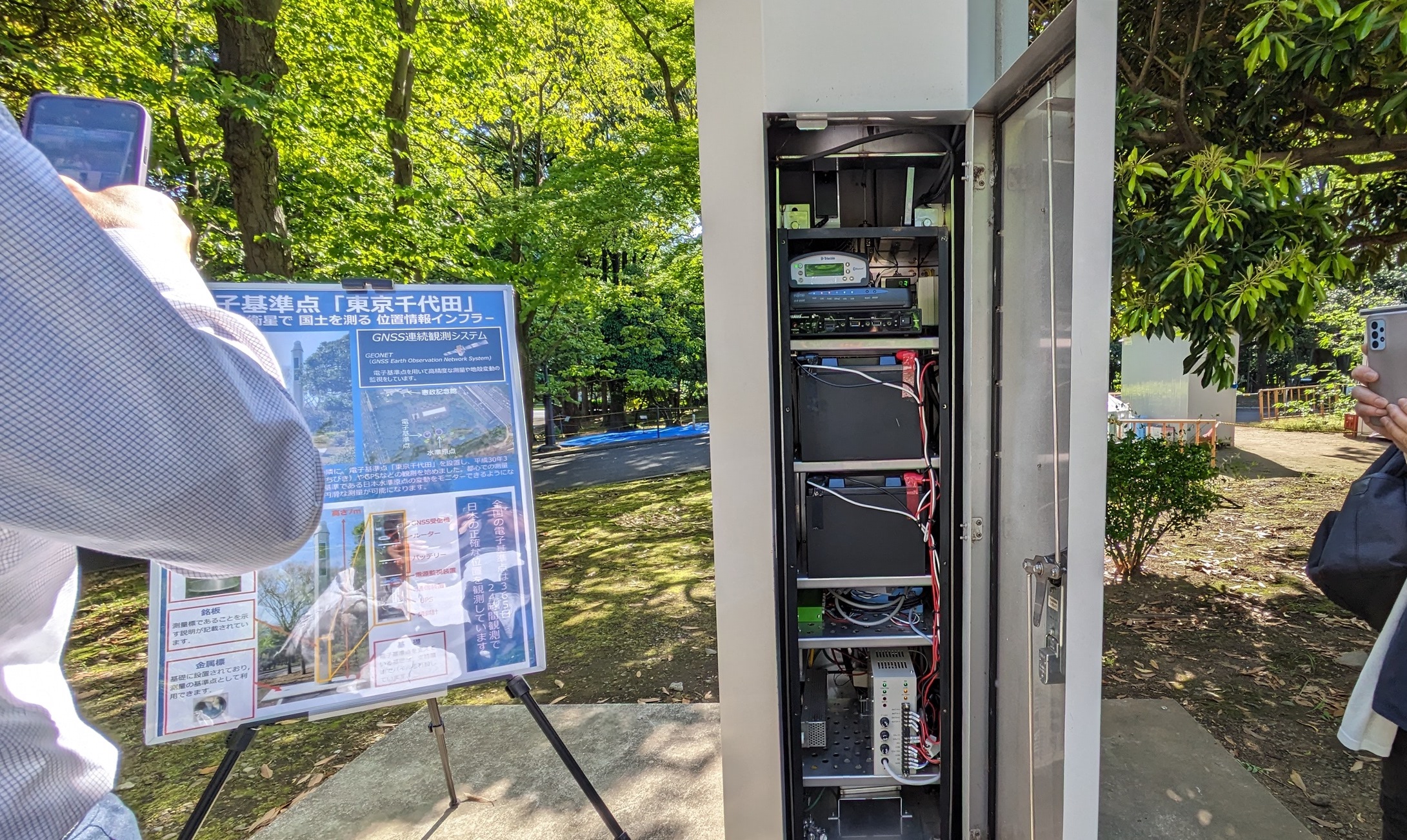
At the end of the electronic reference point is a GNSS antenna (in short, it receives GPS signals)
and inside is an uninterruptible power supply and various other things.
It was a lot of fun.
I had a lot of fun.
- Log in to post comments